Multispectral Mapping For Agriculture
with Drones
Nothing makes a farmer proud like a healthy harvest. You take pride in feeding people with your
hard work, but you also grapple with razor-thin
margins and operate your business at the whims of
mother nature.
Fortunately, there are more technologies and tools
available than ever before for farmers to protect,
nurture, and maximize the productivity and health
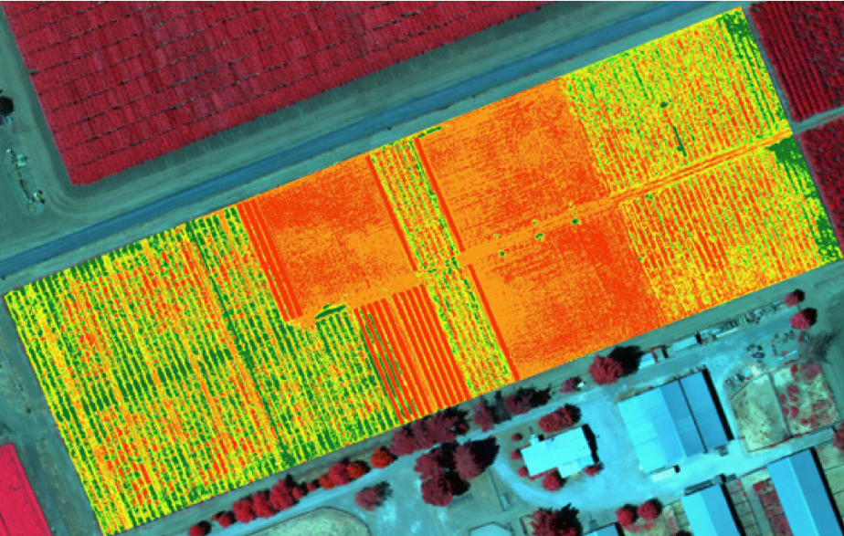
of their farms. In particular, precision agriculture
practices like remote sensing have enabled farmers
to identify issues early, act with assurance, and
eliminate guesswork. As remote sensing data becomes more accessible, the wisest of farmers and
agronomists are eagerly integrating this information into their decision-making processes to stabilize income while minimizing impact on the environment.